The Alqueva Dam sits on the river Guadiana between the municipalities of Portel and Moura, next to the village of Alqueva that gave it its name. From Mourão it is about 50 minutes by car, going round the lake to the south.
You can visit freely and without booking: the road runs along the top of the dam wall, there is a car park and free binoculars on the crest, and next door is the Alqueva Centre, run by EDIA, with an exhibition about the project. This guide covers what you will see, how to get there, what is nearby and why the map lies.
What the Alqueva Dam is, in numbers
EDIA — the public company that runs the scheme — describes the reservoir as the largest artificial lake in Europe. Every figure below is official:
| Value (EDIA / CNPGB) | |
|---|---|
| Surface area at full level | 250 km² |
| Shoreline | more than 1,100 km |
| Length of the reservoir | 83 km |
| Total capacity | 4,150 hm³ |
| Full storage level | 152 m |
| Height of the dam | 96 m |
| Length of the crest | 458 m |
| Type | double-curvature concrete arch |
| Gates closed | 8 February 2002 |
| First time at full level | 12 January 2010 |
The reservoir spreads across the municipalities of Moura, Portel, Mourão, Reguengos de Monsaraz and Alandroal. Water for irrigation, drinking supply and electricity — the power station has two 260 MW units — and, almost by accident, a landscape that did not exist before.
Where the dam wall is and how to get there from Mourão
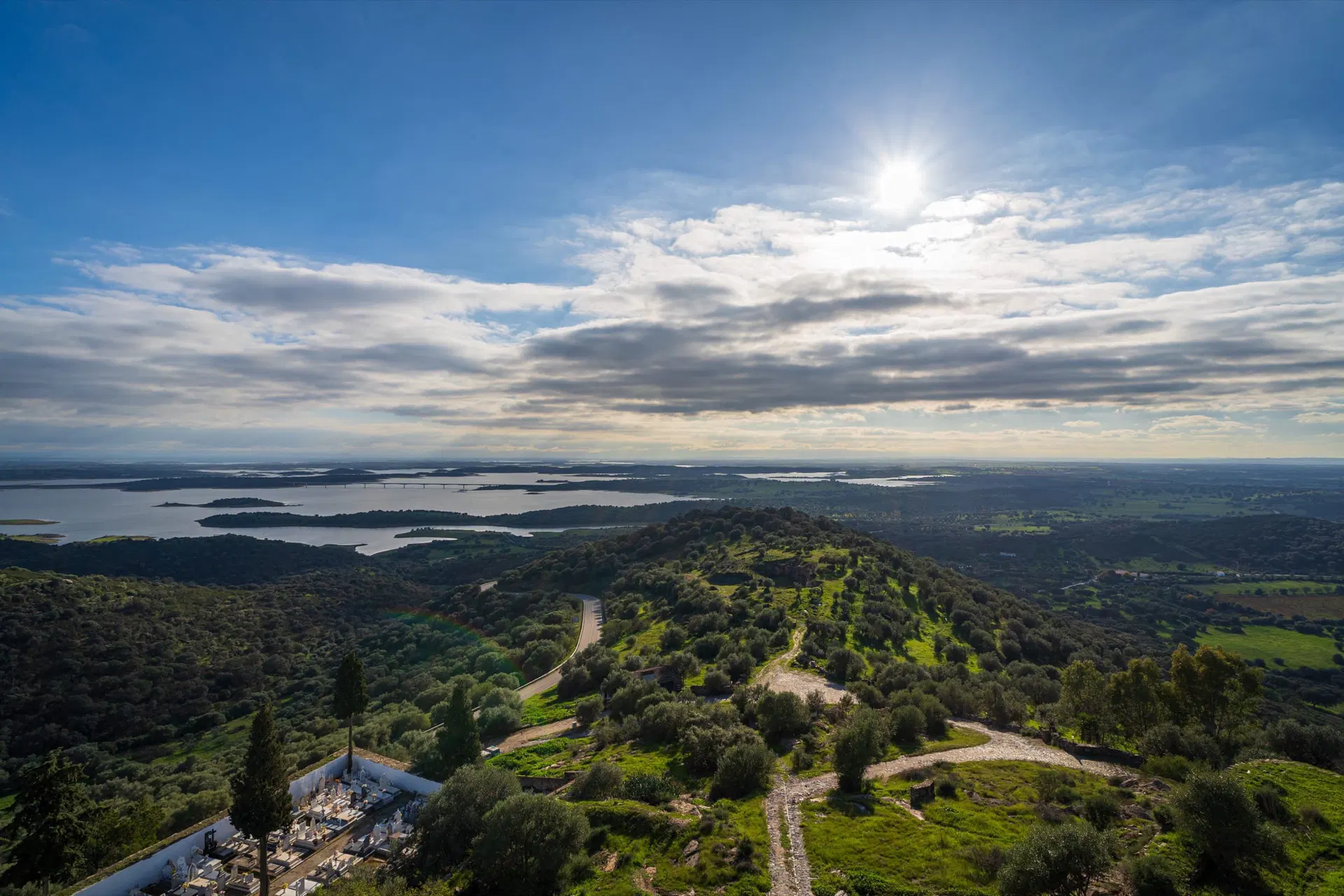
The dam wall is south of Mourão, at the narrowest point of the Guadiana valley. The drive follows the EM 517 and the EN 386 through Póvoa de São Miguel, then joins the ER 255, which reaches the dam on the Moura side. Allow about 50 minutes — Portel council gives the coordinates 38.197660, -7.496405 for the viewpoint over the Great Lake.
From Moura it is about 15 minutes. Coming from the north via Portel, you arrive at the other end of the dam wall, through the village of Alqueva.
Can you cross it, stop, and look out from a viewpoint?
Crossing: yes. The ER 255 links Portel to Moura over the crest of the dam, which is why the crossing is part of any loop round the southern end of the lake.
Stopping: yes. There is a car park by the dam wall. In February 2022 EDIA installed free binoculars on the crest, pointing upstream over the lake, and an information totem showing the 20 municipalities in Alqueva's area of influence and their distances. From the other side of the crest you look downstream: the Pedrógão reservoir and, in the distance, Moura.
The inside: not open on a normal day. The dam's galleries and its observation and control post open on one-off occasions, such as the Open Day EDIA held on 29 May 2024 for European Dams Day, with free compulsory registration. If there is an edition in the year of your visit, it is announced on EDIA's website.
The Alqueva Centre
Next to the dam, EDIA runs the Alqueva Centre, an exhibition and multimedia space about the project: the territory and its history, the construction, the network of dams and canals, the irrigation. It has two immersive rooms, an exhibition area, an 80-seat auditorium and, outside, original equipment from the works and two teaching models showing how the dam operates and how the water is distributed.
It is open Tuesday to Sunday. Guided visits — a multimedia presentation, a film and a short Q&A — are for organised groups, mainly schools and universities, on weekdays at 10.30am or 2.30pm, booked in advance and free of charge. The contact is cial@edia.pt.
What is near the dam
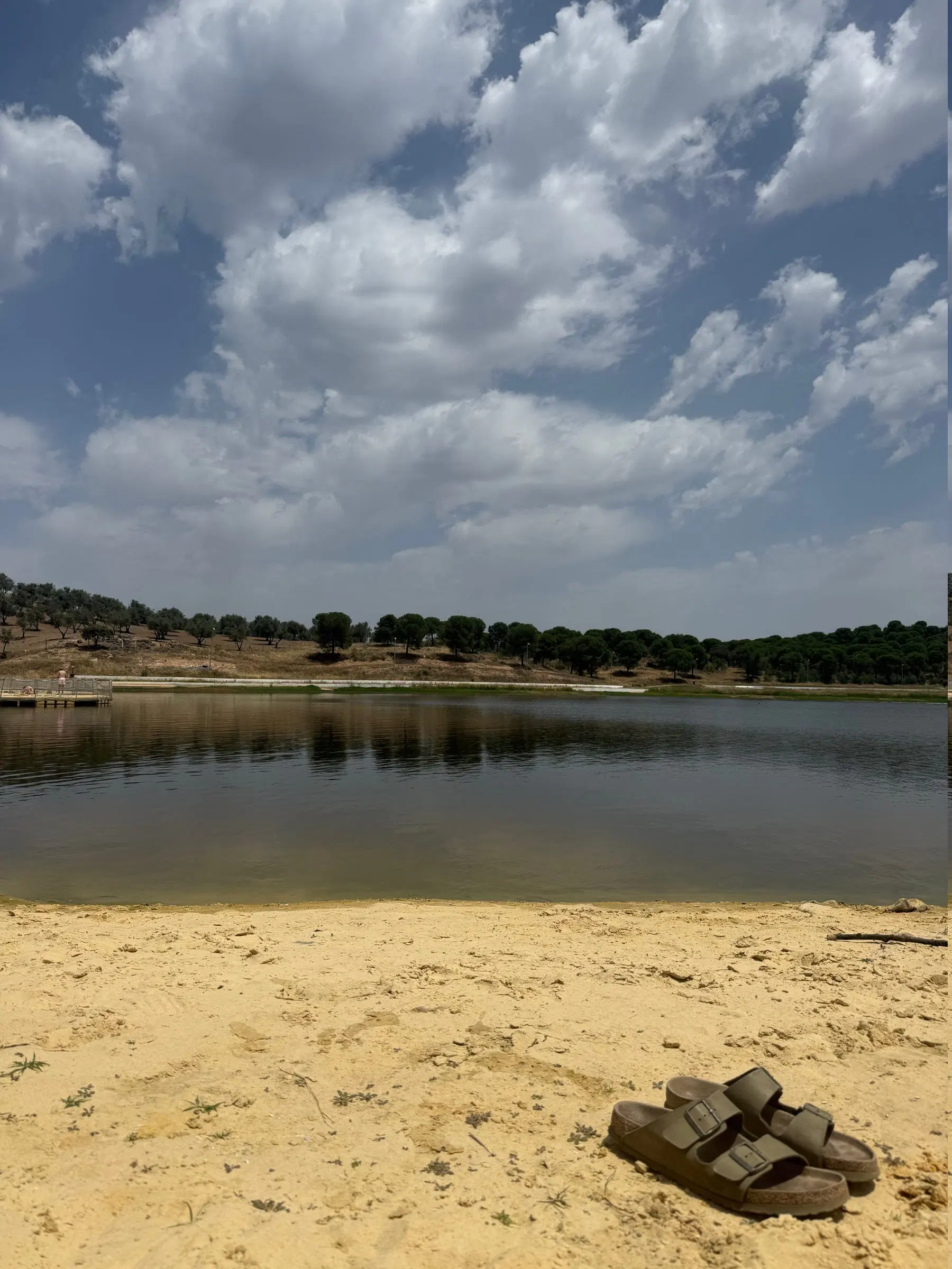
Praia Fluvial de Alqueva. About 1.5 km from the village, in the municipality of Portel, and holding a Blue Flag in 2026. It has around 150 metres of lifeguarded sand, a lawn with awnings and thatched shades over more than 15,000 square metres, a fenced-off bathing area for children, facilities for people with reduced mobility and a bar-restaurant overlooking the lake. During the bathing season lifeguards are on duty from 9am to 7pm. It is the natural end to an afternoon at the dam. The lake's six Blue Flag beaches →
Moura. The town is about 15 minutes from the dam wall, on the Beja side, with a castle, a bullring inside the walls and a lake beach of its own. What to see in Moura →
Aldeia da Luz and the Museu da Luz. They are on the other side of the lake, 20 minutes from the house and about 45 minutes from the dam — do not plan both in the same leg without allowing for that. The museum is run by EDIA, closes on Mondays and keeps different hours in summer and winter; check museudaluz.org.pt.
The village that went under the water
When the gates closed, the water rose and covered the village of Luz, in the municipality of Mourão, home to 423 people. The village was built again, two kilometres uphill, and the museum keeps the memory of the old one. There is no point retelling the story here: it is told in the Aldeia da Luz guide, and it is the most moving visit in the region.
Why distances lie around the lake
More than 1,100 km of shoreline and very few crossing points. Between the Mourão bridge, to the north, and the crest of the dam, to the south, there is no way to get from one bank to the other by car.
The result is that two places that look like neighbours on the map can be an hour apart by road. Aldeia da Luz and the dam are both on the lake shore, under 20 km apart in a straight line, and the drive between them is around 45 minutes. Amieira Marina, 50 minutes from Mourão, is a few kilometres of water from the dam wall — and a good many kilometres of road. Plan the day by driving time, never by kilometres. How to get to Alqueva and why the map lies →
The best time to visit
Spring. After a wet winter the reservoir comes close to its full level, the plain is green and the contrast with the water is the best of the year. EDIA publishes the reservoir level on its website; at 152 metres the lake is full.
September and October. Bearable heat, low light in the late afternoon, and the lake beach still open in the first half of September.
July and August. Worth it for the beach, not for the dam wall in the middle of the day. Go early in the morning or late in the afternoon, when the sun is already low over the lake.
Winter. Short, cold days, but the lake is usually fuller and there are far fewer people. It pairs well with a night of stargazing — the Alqueva sky is at its best in this season.
The dam makes a good final leg of a day round the lake: a morning at the Mourão lake beach, lunch, an afternoon drive south to the dam wall and back the same way at sunset.
Common questions
Can you visit the Alqueva Dam?
Yes, and without booking. The ER 255 road runs along the crest, there is a car park by the dam wall and free binoculars installed by EDIA, the public company that runs it. Next to the dam is EDIA's Alqueva Centre, open Tuesday to Sunday, with an exhibition about the project. Guided visits are for organised groups, by prior booking, on weekdays.
Can you drive across the Alqueva Dam?
You can. The regional road ER 255 links the municipalities of Portel and Moura over the 458-metre crest of the dam. Coming from Mourão you arrive on the Moura side and cross to the village of Alqueva, on the Portel side.
How far is the Alqueva Dam from Mourão?
About 50 minutes by car, going round the lake to the south through Póvoa de São Miguel. As the crow flies it is much closer, but there is no crossing of the lake between the Mourão bridge and the dam wall.
How big is Lake Alqueva?
According to EDIA, at its full level of 152 metres the reservoir covers 250 km², has more than 1,100 km of shoreline, is 83 km long and holds 4,150 million cubic metres of water. EDIA describes it as the largest artificial lake in Europe.
When was the Alqueva Dam closed?
The gates were closed on 8 February 2002. The reservoir reached its full level for the first time on 12 January 2010, almost eight years later.
Is there a beach at the Alqueva Dam?
There is. Praia Fluvial de Alqueva is about 1.5 km from the village, in the municipality of Portel, holds a Blue Flag in 2026, has lifeguards from 9am to 7pm during the bathing season, a fenced-off shallow area for children and a bar-restaurant looking over the lake.